
July 1-3 Canada Day Long Weekend
Tyrolean crossing Squamish River, Lake Lovely Water, Mt Iota, Mt Pelops
LAKE LOVELY WATER STATS
Elevation 1150m high
MOUNT IOTA STATS
Elevation 1863m high
Prominence 52m
MOUNT PELOPS STATS
Elevation 2015m high
Prominence 105m
Our plan for the Canada Day long weekend was to camp 2 nights and hike 3 days. Knowing how busy it’s going to be, we wanted to be away from the crowds, so Lake Lovely Water (LLW) was a good option. With limited access to LLW, we had to figure out how to get across the river. The boat was out of the question as we contacted many of the private boaters that refused to cross because of the currents. So we were left with only a few options. Either spend a whole lot of dough taking a jet ski or a helicopter ride. Or Tyrolean across the river with our gear.
With the consensus of everyone in the group for the sake of saving money and being adventurous, we agreed to do the Tyrolean crossing. Link to UBC-VOC we used for referring to the diagram and description of the equipment needed and setup for Tyroleaning across. So we prepared our gear and did some last minute shopping at MEC for gear.
On Canada Day at 6am, I picked up everyone (Farhad, Karlie, Thery, and Quynh), then drove from Vancouver to Squamish. We caffeinated up at Starbucks in Squamish, drove to the First Nations land via Squamish Valley Road (which is about 16km northwest of Squamish), arriving at 9am and parked outside of the gate. Knowing the risk of parking our vehicles there, we hid everything in the trunk and made sure we parked on the side to allow vehicle access in and out of the gate. (Note: We called Squamish Nations Totem Hall for permission to cross their land to the river and were granted to cross their land)
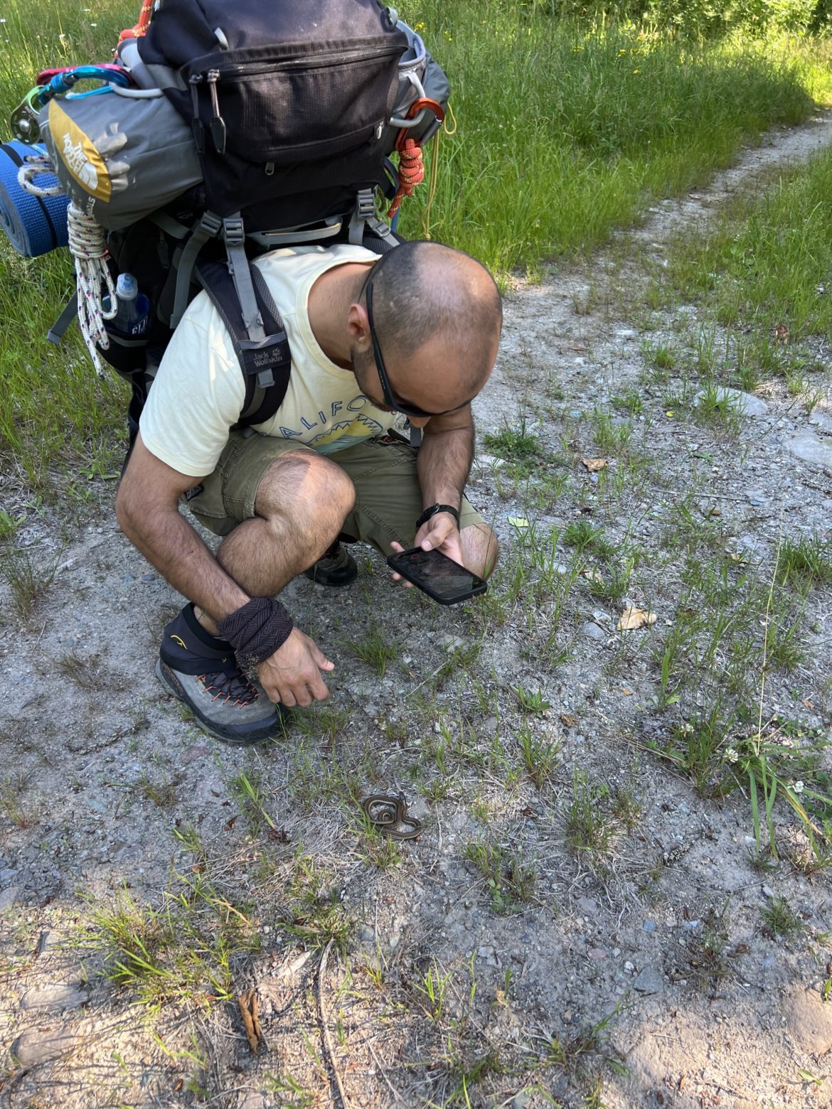
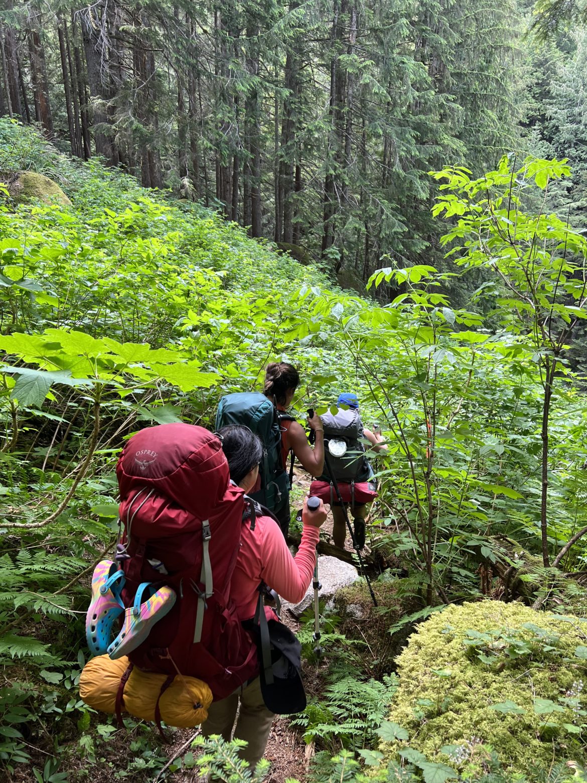
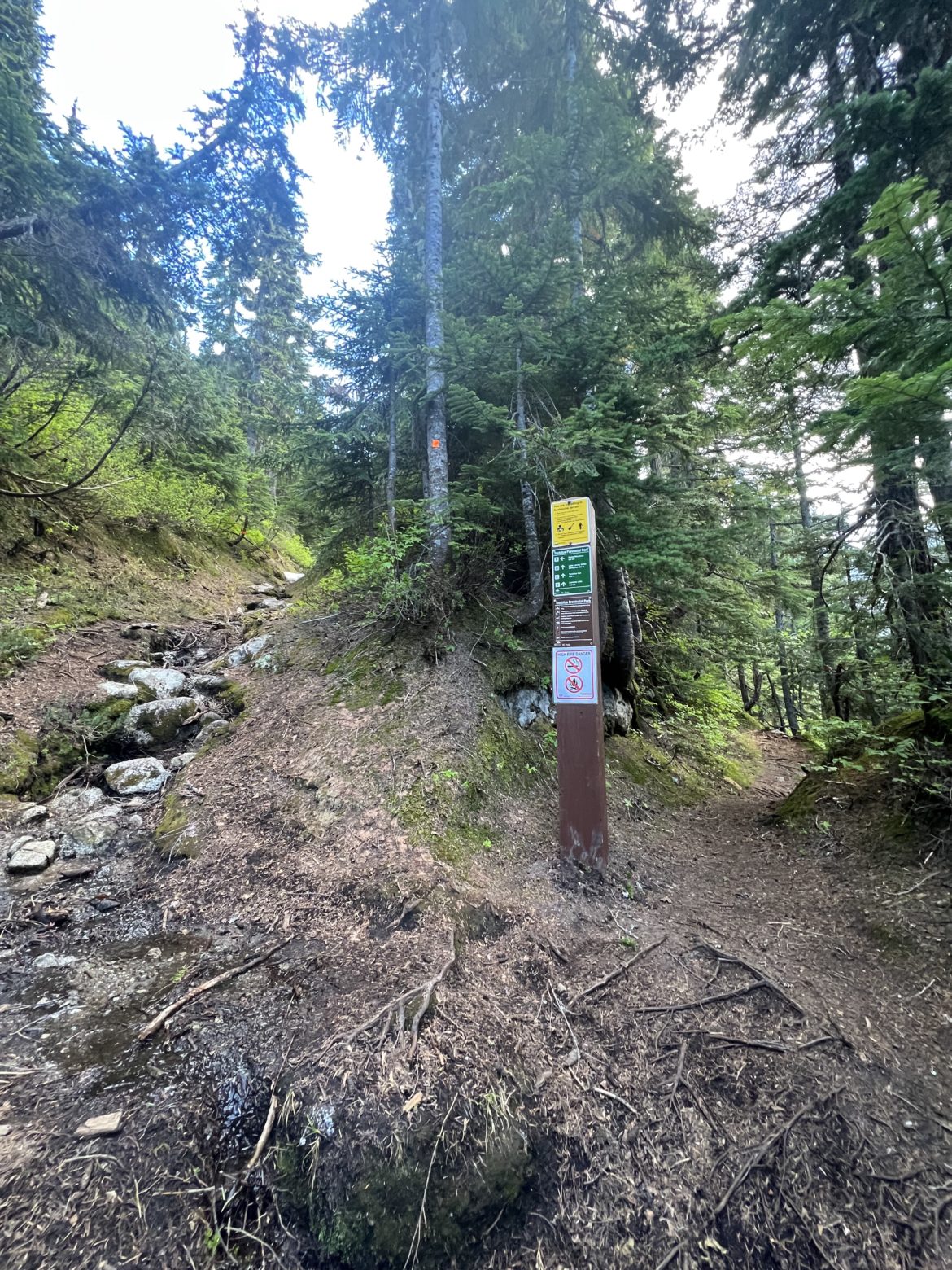
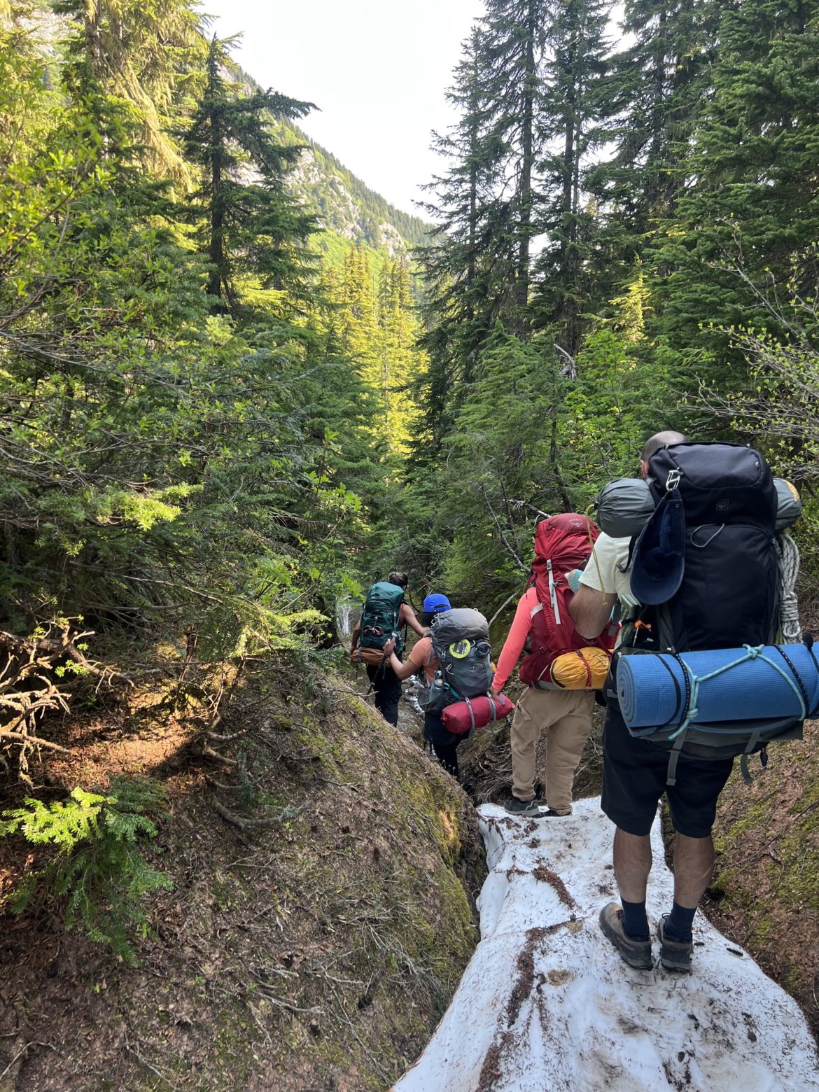
Once we prepared and checked that we had everything, we began to hike towards the river which is 1.5 km away. After hiking for 20 minutes, we reached the crossing at 10am. Due to safety concerns and security reasons, I won’t detail how we crossed the river. It took us 4 hours to cross over. Everyone was exhausted and felt defeated after the crossing. Lots of upper body workout for sure. So we took a 20 minute break to fuel up.
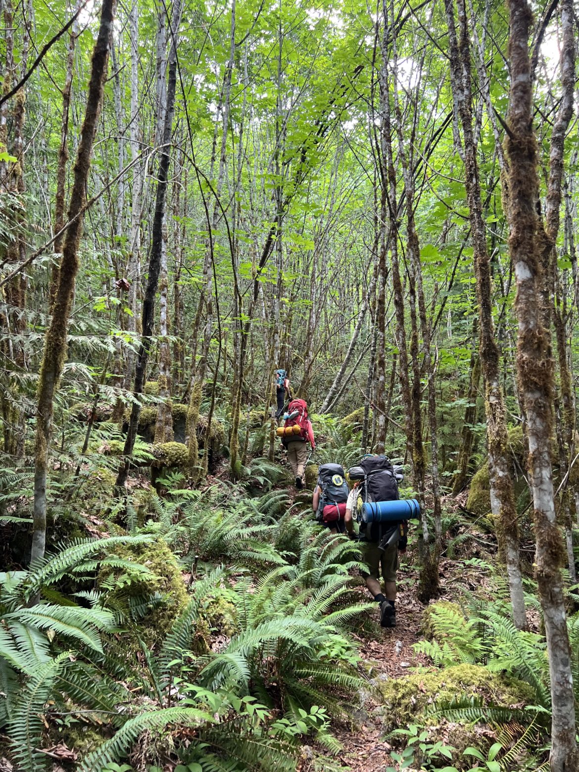
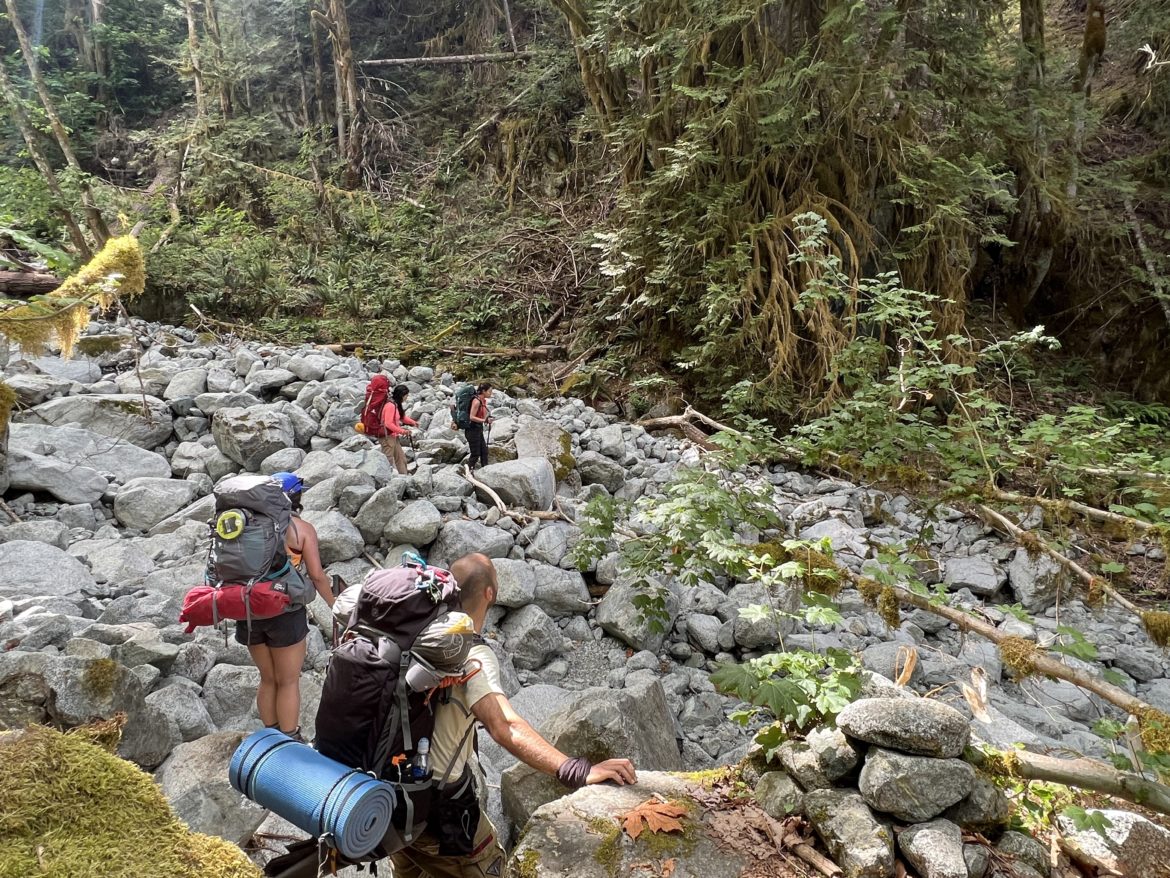
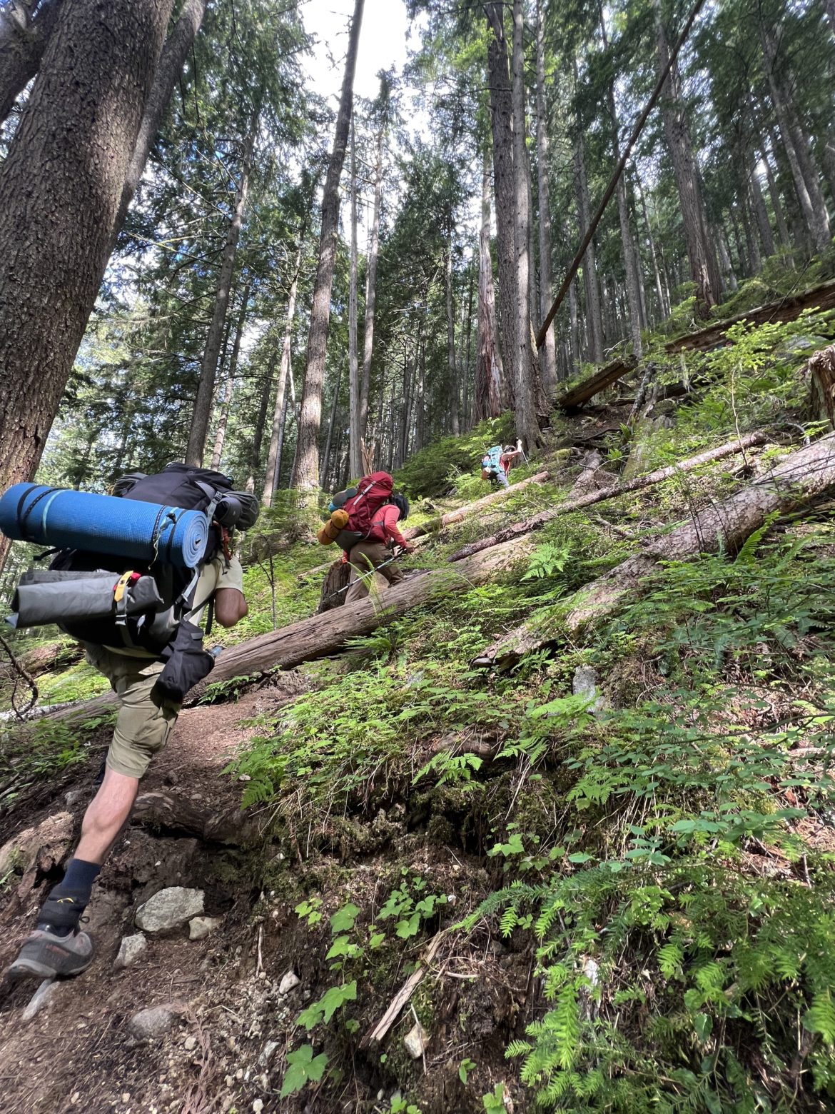
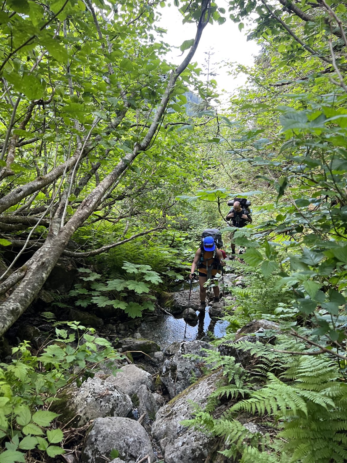
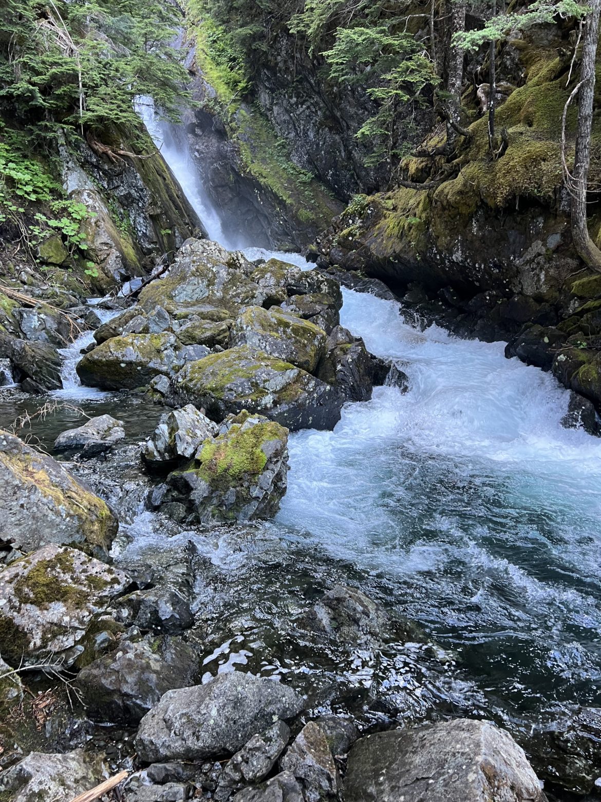
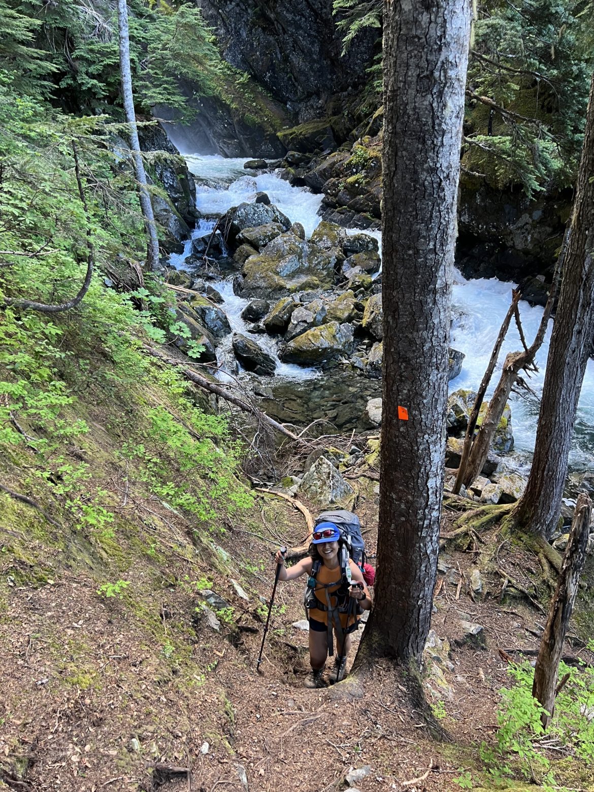
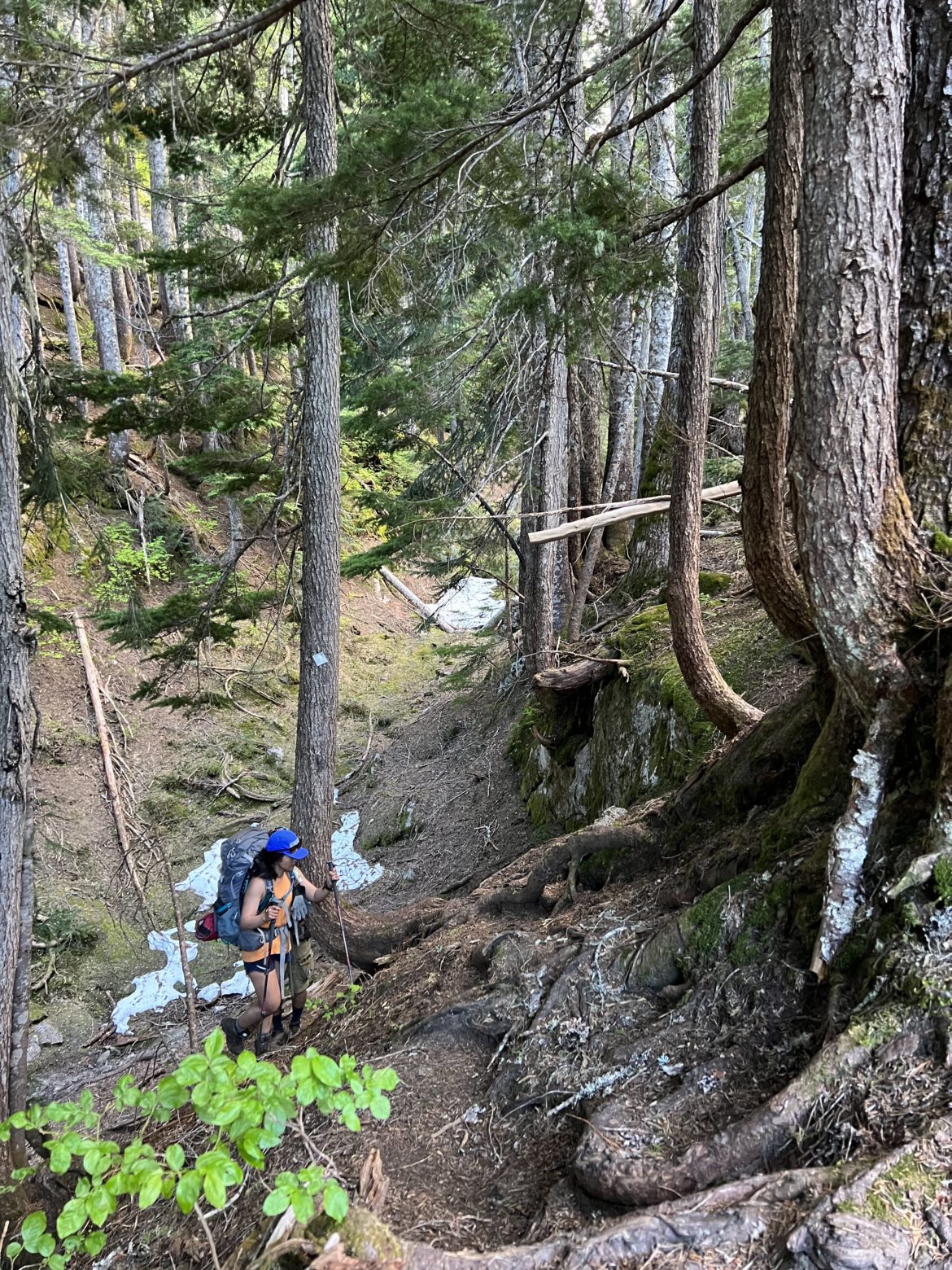
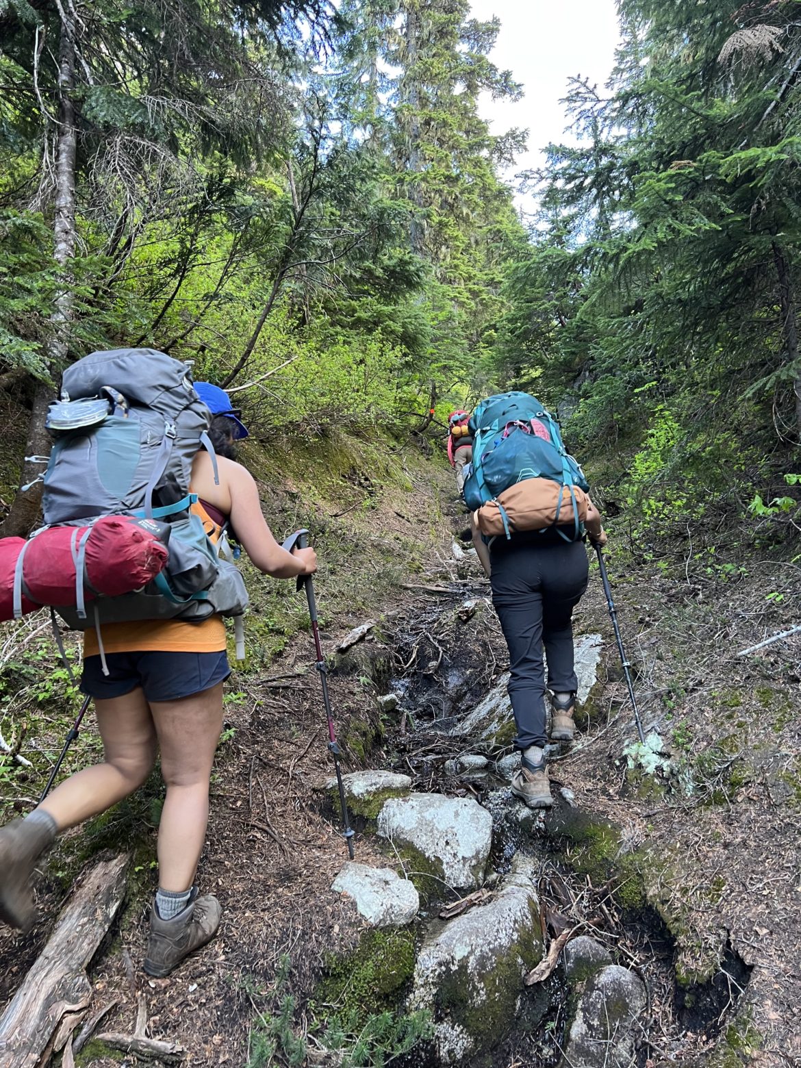
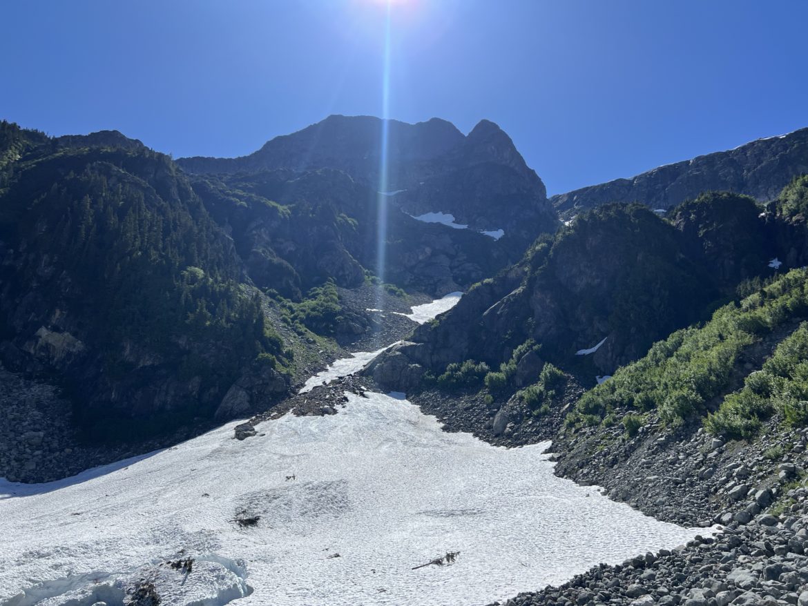
Just after 2:30pm, we then began to hike up LLW gaining 1150m of elevation in 5kms. The trail is fairly well maintained and marked. Going through elevated trails, rocks, bushes and crossings, we all felt quite exhausted 3/4 of the way in. We took a nice 15 minute break at the 600m elevation spot.
After, we continued and the last 200m elevation gain was quite steep and and some of the members started to slow down. The hike up took us nearly 5 hours to LLW. Normally would only take about 3.5 hours. But since the gang was quite exhausted from the cable crossing, we didn’t really think about time as the summer days were longer.
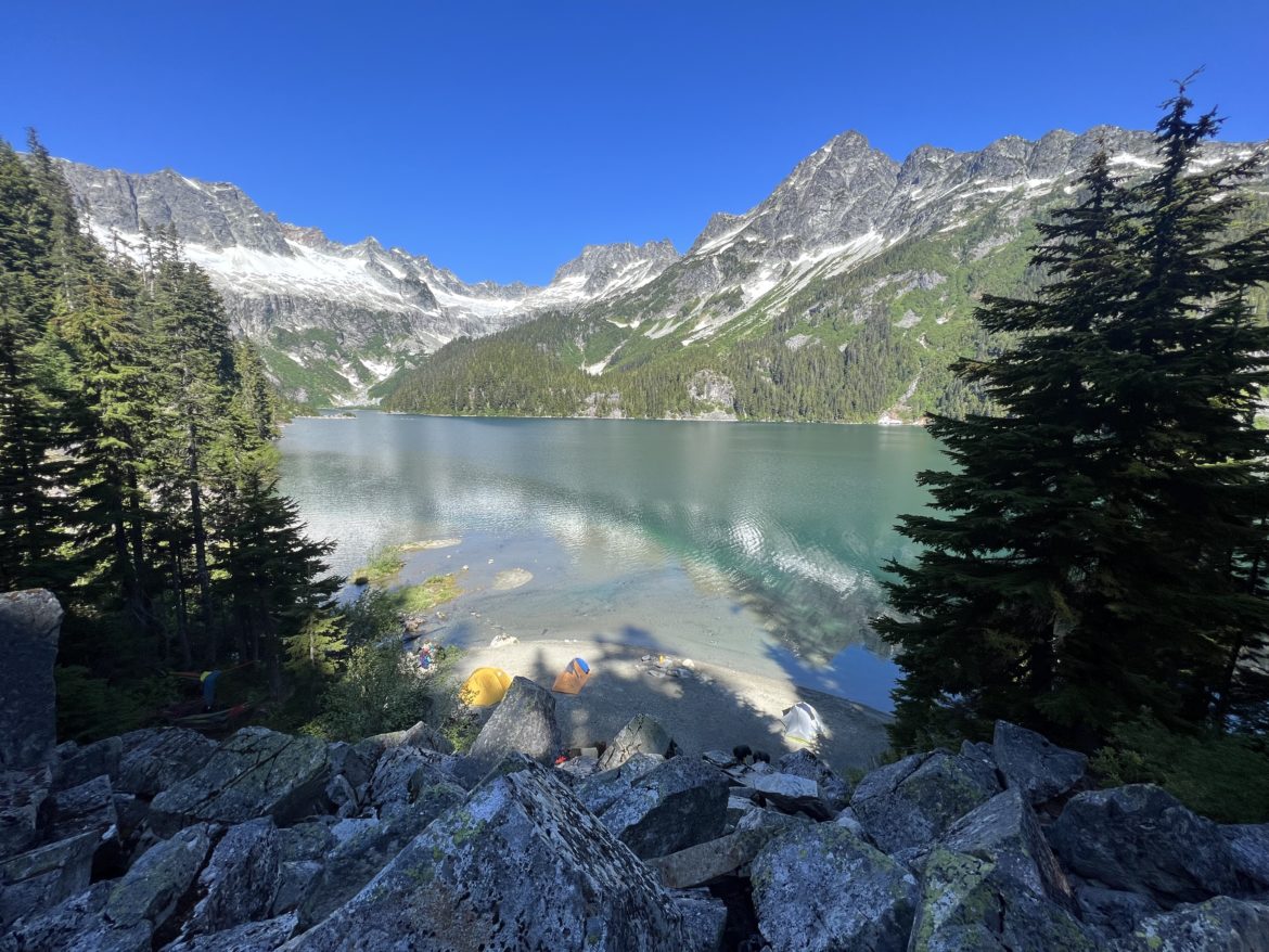
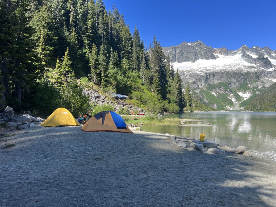
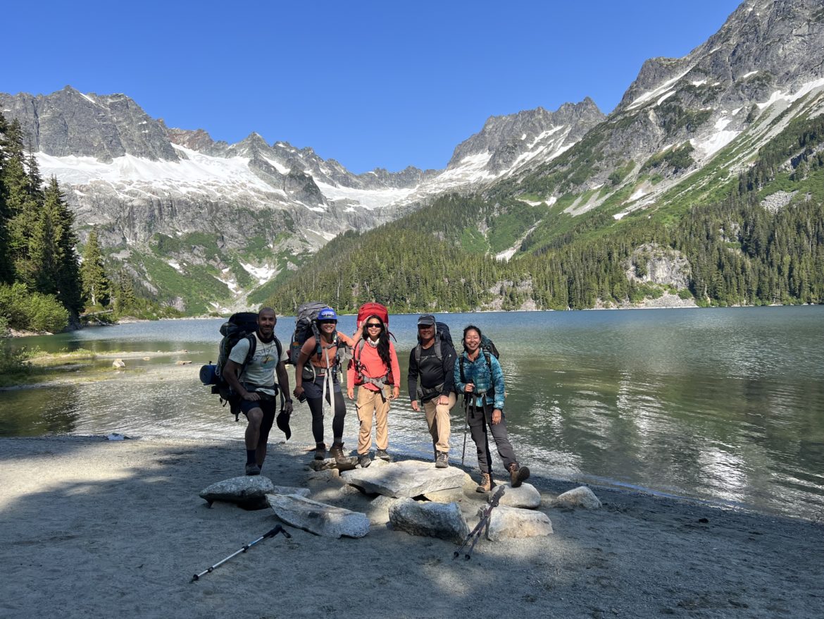
After arriving near the Tantalus Hut, all the tent pads where taken. So our only option was to camp at the beach. We went back towards the fork in the Niobe Meadows direction. The girls were quite exhausted at that point, so they decided to set up camp 300m in from the fork. While Farhad and I decided to hike further in to the beach where we both eventually camp for the night. After finding the beach, I hiked back where the girls were and at that point, the girls just wanted to stay put for the night and meet us at the beach the next morning. So I went back to the beach, ate, washed up and turned in.
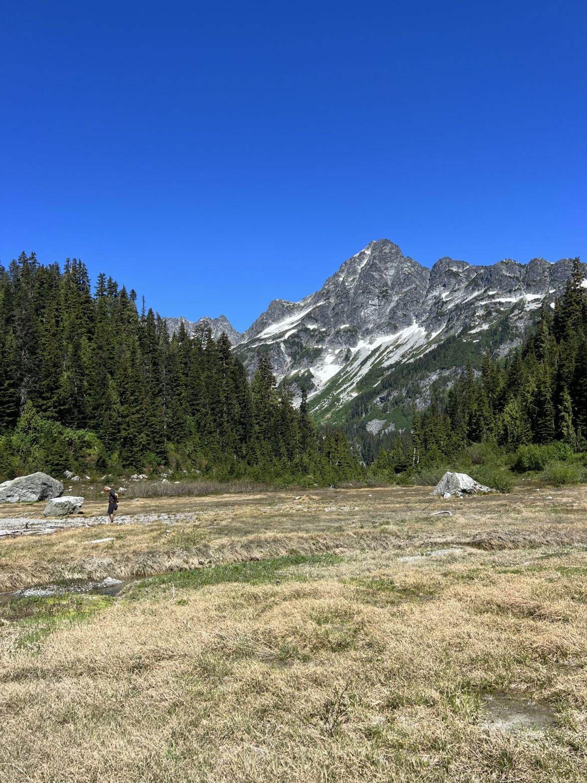
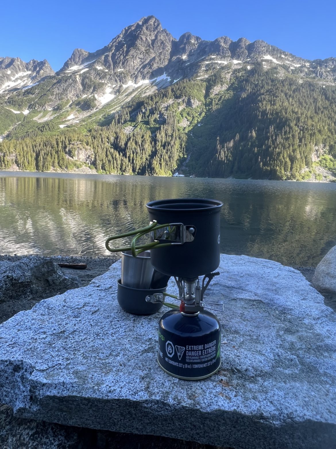
The next morning, I woke up at around 6am to the early sunrise with the beautiful reflections of Lake Lovely Water. Had my oatmeal, relaxed and then geared up. Farhad then got up. We both were ready to summit a peak but we had no idea which mountain to summit. Mt Tantalus was out of the question as it was going to be a long day for us where we had to hike back to the main campgrounds. So instead, just after 10am, we scrambled up the boulders along the river and within 10-15 minutes, we reached the meadows surrounded by mountains (Omega, Mt Iota, Mt Pelops, Mt Niobe). Before leaving our beach campsite, our plan was to summit Omega. But after assessing the access from the meadows, Farhad and I decided that it would be easier to summit Mt Iota.
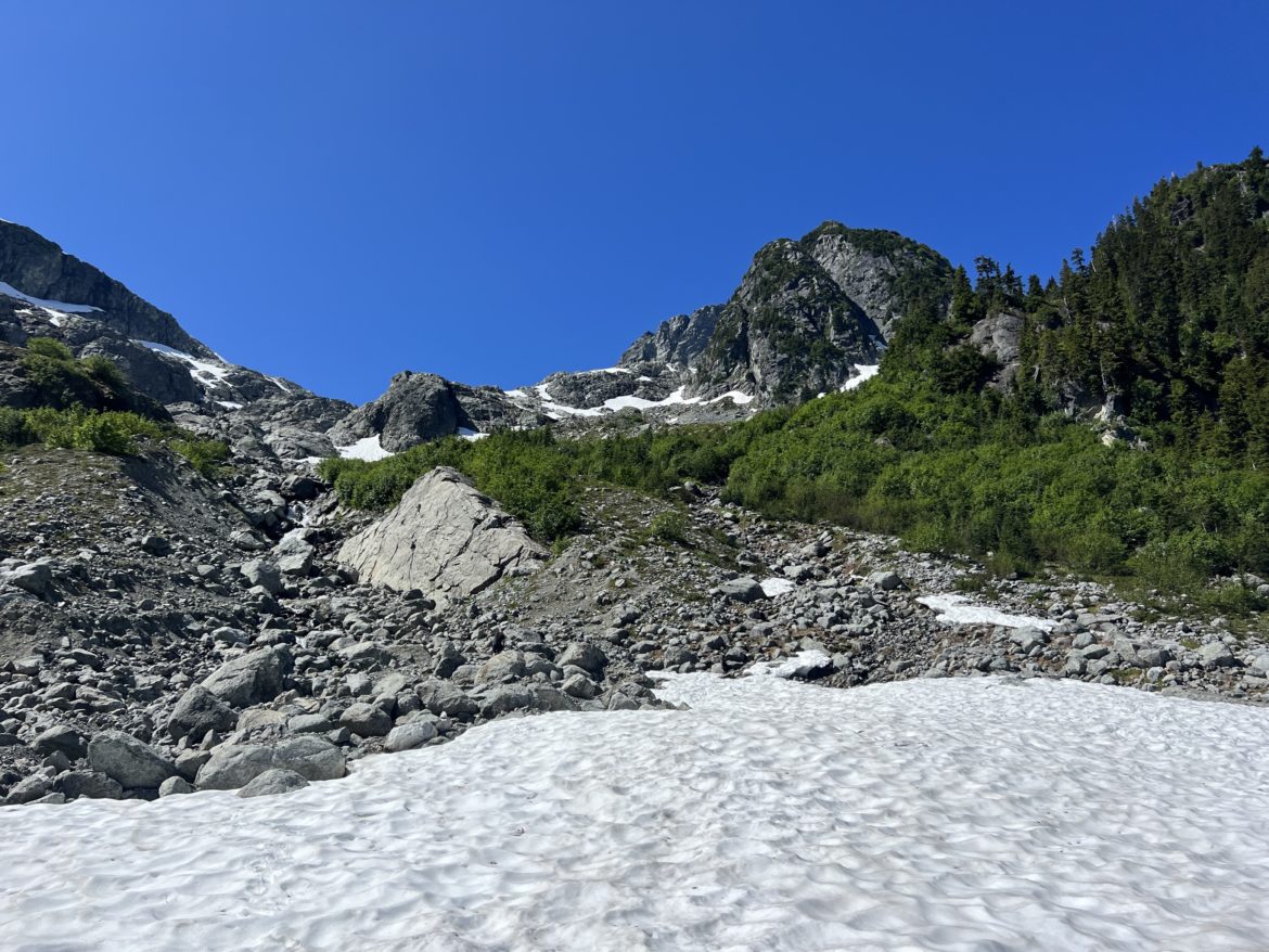
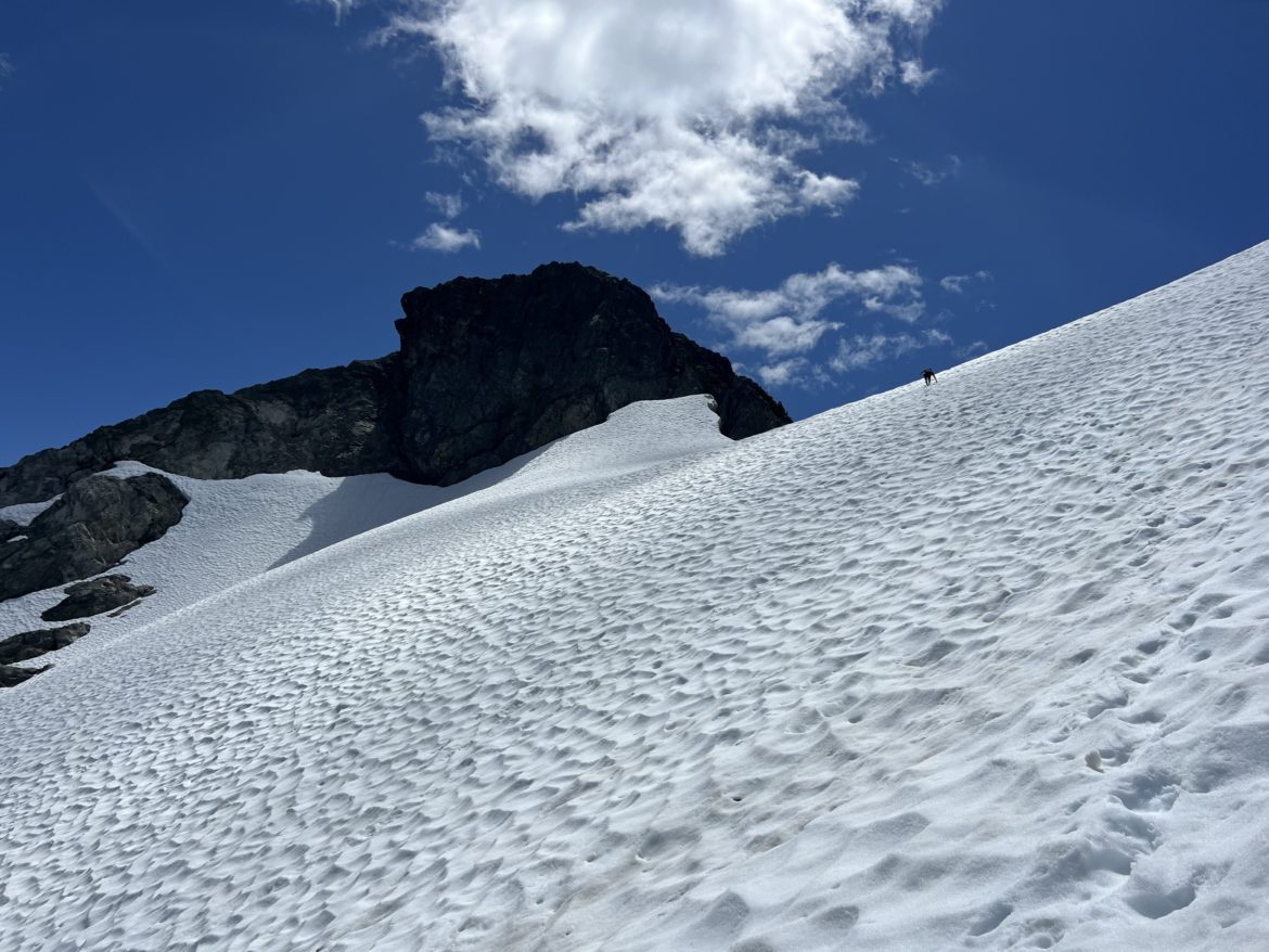
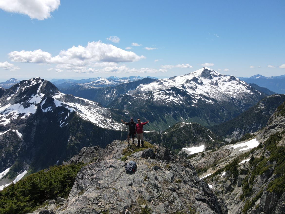
So we hopped over the river stream, traversed across the meadows towards southwest, followed the path up to the rocks and avoiding the glaciers, and traversed up the glacier 150m before the col of Iota and Pelops. From the col, we veered towards Mt Iota which was completely bare from snow. Took us about 10 minutes to climb up and at the top by 1pm. Quite easy. Amazing views from the top with sight of Mt Garibaldi, Omega and Pelops nearby. We spent a good 20 minutes at the top.
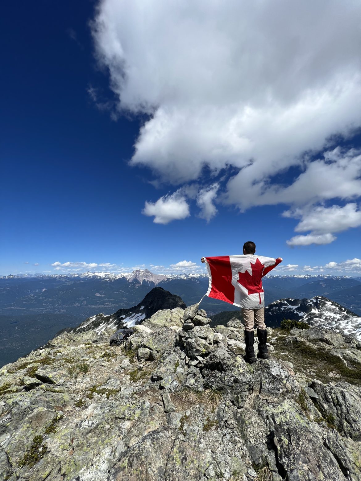
Since we still had lots of time left in the day, Farhad and I decided to summit Mt Pelops which was about 152m higher than Mt Iota. Right at 1:30pm, we went back down to the col and scrambled up Mt Pelops taking us about 30 minutes. Views were so much more incredible with Mt Tantalus and Alpha in sight. There was no wind at all and the sun was blasting. We spent about a good hour at the top indulging the views and celebrating Canada Day a day late at the summit.
After spending some really good time up there, we started to descend down the peak, and from the col, we just traversed fast down the glacier and being aware of crevasses. By 5pm, we reached back to our beach campsite and met with the girls who we haven’t seen since last night. We were the only ones at the beach plus a couple from Toronto. We spent the rest of the afternoon and evening sun tanning, swimming and just enjoying the scenes around. We then turned in before 11pm as we planned to leave by 9am the next morning to hike back.
Monday morning came and it was 6:30am. I woke up and did my morning thing. Thery then woke up soon after me and did her stretches. Others woke up an hour before we left. We had our breakfast, chilled a bit, packed up, and began our hike back at 9am. We took our sweet ass time and eventually made it back to the river and prepared to cross back at 1pm.
Crossing the river was faster this time as we knew what to expect. By 5pm, we were all back across the river safe and exhausted but had fun. We then quickly hiked back to our car in about 30 minutes.
Mission Accomplished! We were all excited about food and ice cold craft beer at A-Frame Brewing & Flipside Burger in Squamish.